¶ Preparation
Select the drone flight or model on where you want a cross section over.
Select "DEM" (Digital Elevation Model) it's easier to see the shapes.
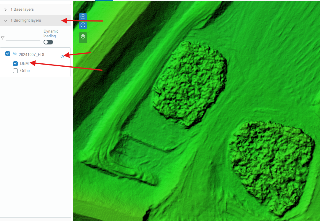
Now open Linaster tools and select "volume".
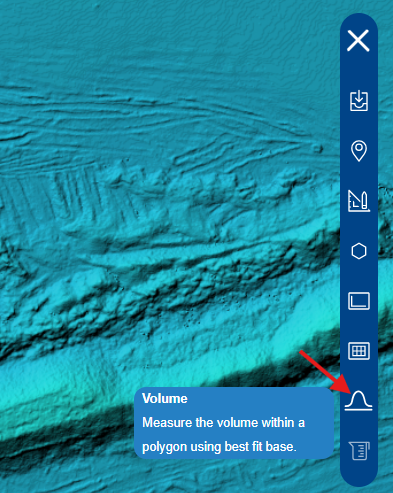
You now have two possibilities, make a polygon by hand or select a predefined "Zone" from Linaster.
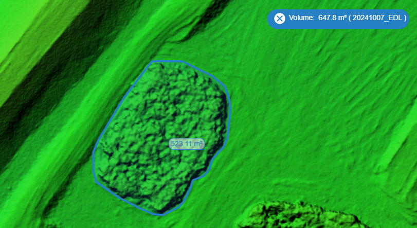
¶ By hand
- Left click on the first point of polygon on map and continue left click as many you want.
- Hit enter on keyboard.
- The tool will create a virtual platform where the Z will be obtained by the clicked points. And return the volume over this platform.
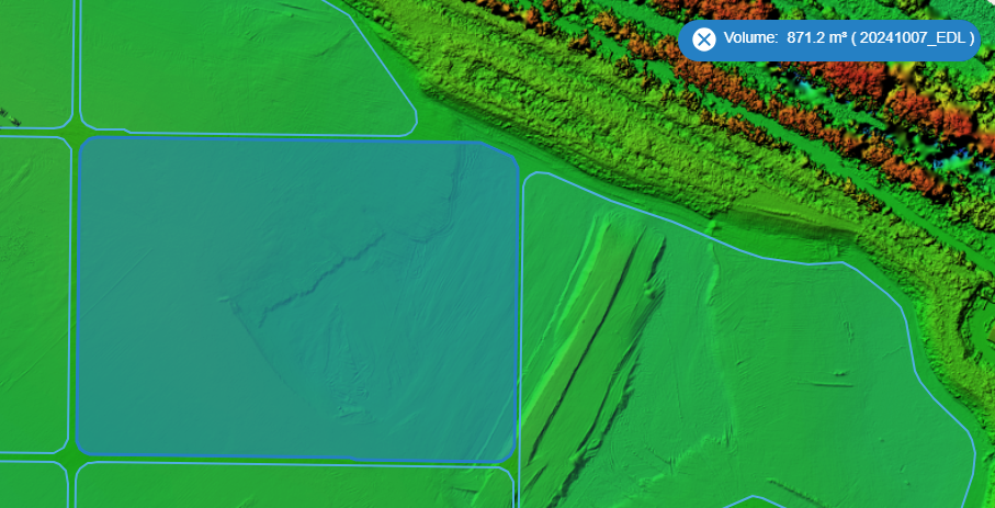
¶ By predefined polygon
- In the drop-down list select the "Zone" already present in Linaster.
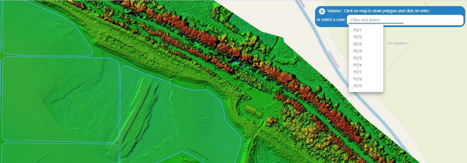
- The tool will create a virtual platform where the Z will be obtained by the vertices of the polygon. And return the volume over this platform.
¶ Conclusion
This tool is not accurate because the surface created by the polygon try to make "best-fit" in point cloud (the green line below). So at the center of polygon it could be for example a gap (the blue line) so the volume between blue and green line will not be counted.
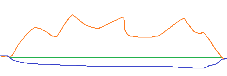
Blue line: the terrain before the stock (TN).
Green line: the polygon created and bestfited to the orange one.
Orange line: the terrain to calculate the stock.
So this tool is usefull and quick for stock calculation if your platform below your stock is flat.