¶ Introduction
This document describes the complete procedure for performing a photogrammetric survey with the DJI M3E drone, from preparation through data processing in Linaster. This procedure covers flight plan creation, RTK base georeferencing, ground control point (GCP) preparation, flight execution, and data processing.
¶ At the office
¶ 1. Pre-flight Preparation
¶ 1.1 Flight Zones and Conditions
¶ 1.1.1 Restricted, Prohibited, and Controlled Zones
Before any flight, it is imperative to verify authorized flight zones according to the country:
¶ 1.1.2 Weather
Check local weather conditions to obtain optimal flight conditions.
It is prohibited to fly when there is rain and/or winds exceeding 50 km/h.
You can use Windy which provides weather information with wind and cloud base data hour by hour. A mobile application is also available.
¶ 2. Area Flight Plan Creation
¶ 2.1 From a KML/KMZ File from CAD software
There is a bug from Mesura, AutoCAD, QGIS and all other GIS/CAD software. You can't import the kml/kmz into DJI RC directly.
Only Google Earth exports work...
- Open the kml/kmz with Google Earth software.
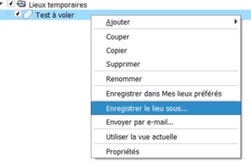
- Right click on the polygon and hit "save to":
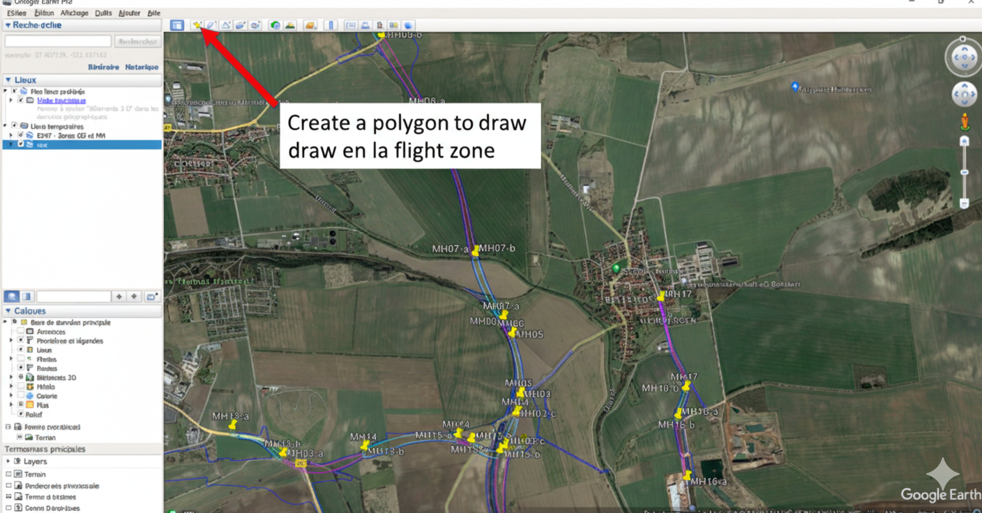
¶ 2.2 Drawing with Google Earth Pro
- Open Google Earth Pro on the computer.
-
In the second tab, change the polygon opacity and color for better visibility.
-
Once the zone is drawn and validated, right click on the polygon and hit "save to":
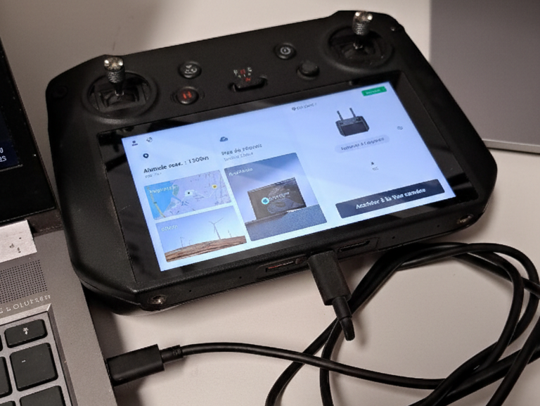
- Connect the remote controller using the USB-C cable to the computer, and turn on the remote controller (1 short press + 1 long press).
-
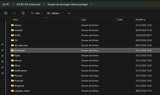
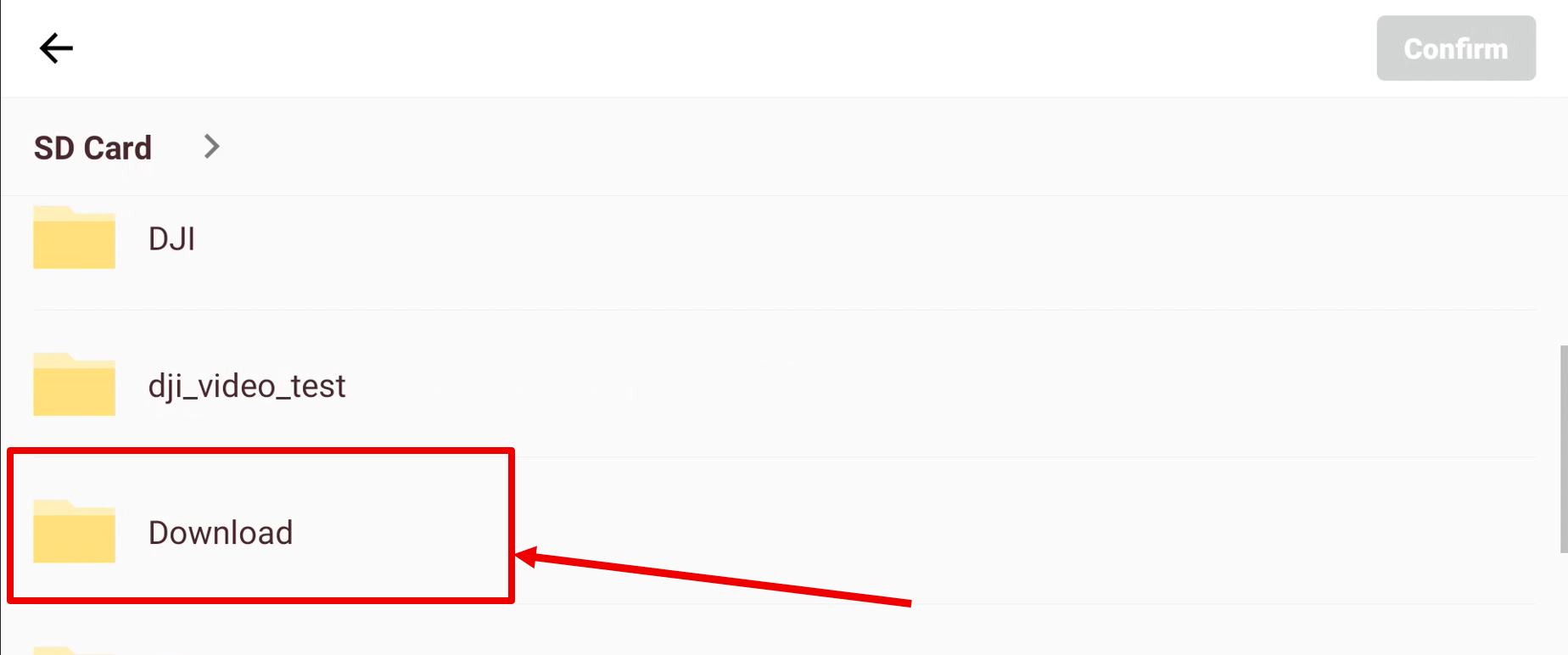
Open File Explorer on the computer, copy the KMZ file and paste it into the Download folder of the remote controller.
Path: This PC / DJI RC Pro Enterprise / Internal Storage / Download
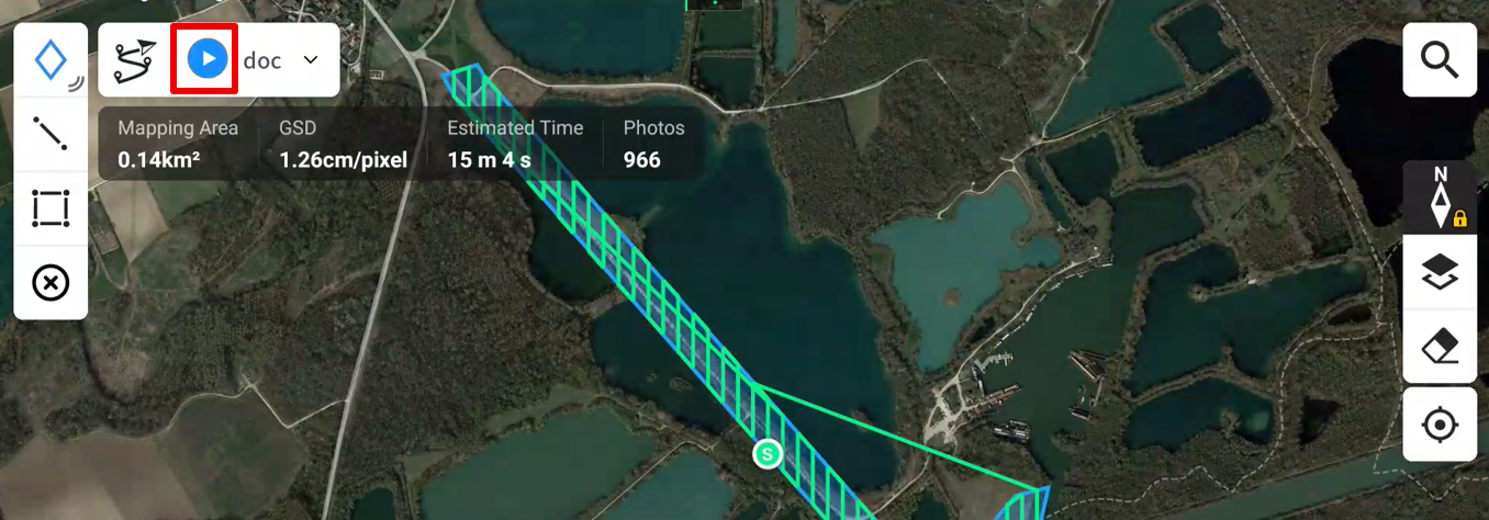
Click on image to zoom
¶ 2.3 Directly into DJI RC
TODO
¶ 3. Flight Plan Parameters
-
Turn on the remote controller.
-
Click on Flight Road.
- Click on Import Route if no flight plan exists. Otherwise, click on the + in the top right corner.
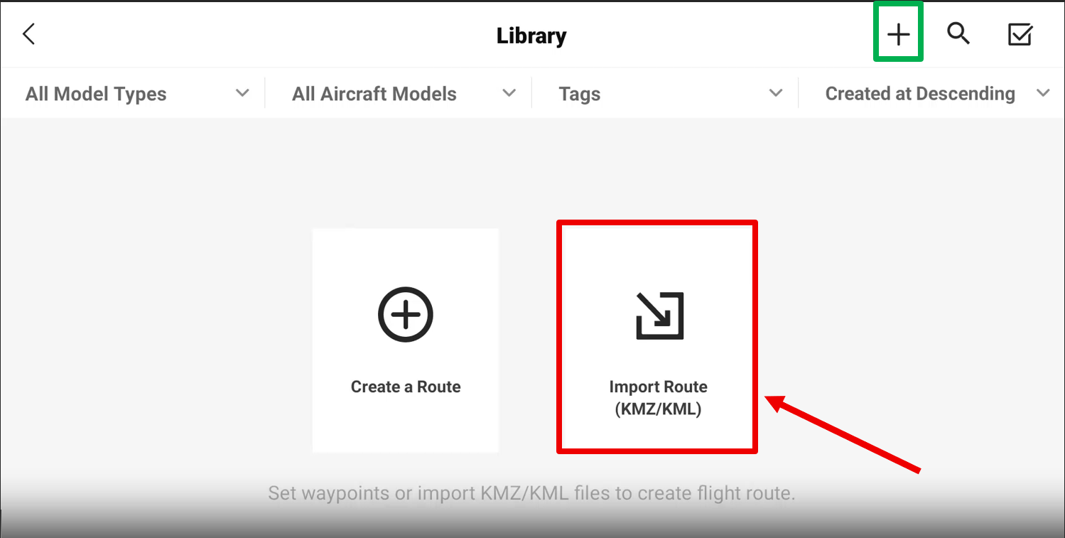
- Click on Download.
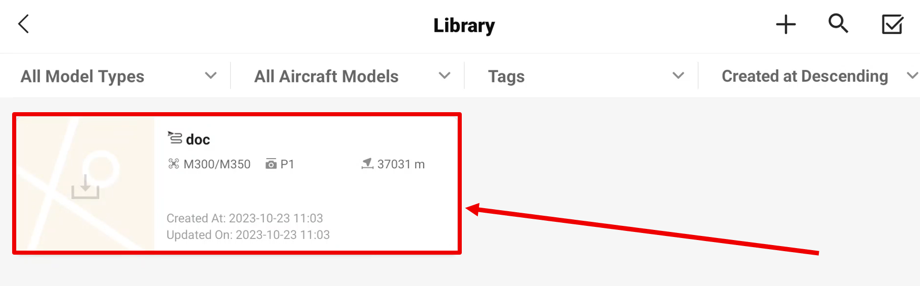
- Click on Area Road.
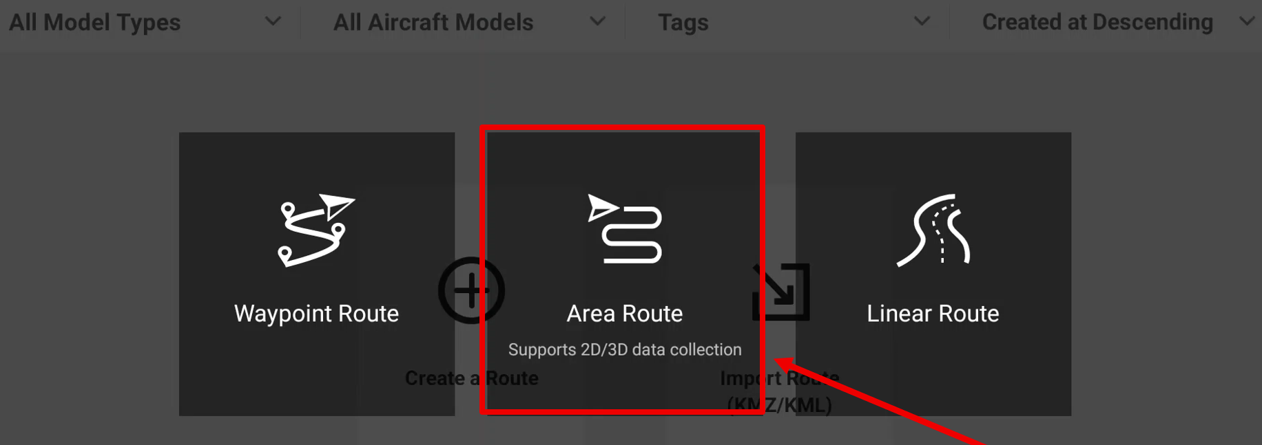
- Click on the imported flight.
- Click on the dropdown menu of the flight in the top left.
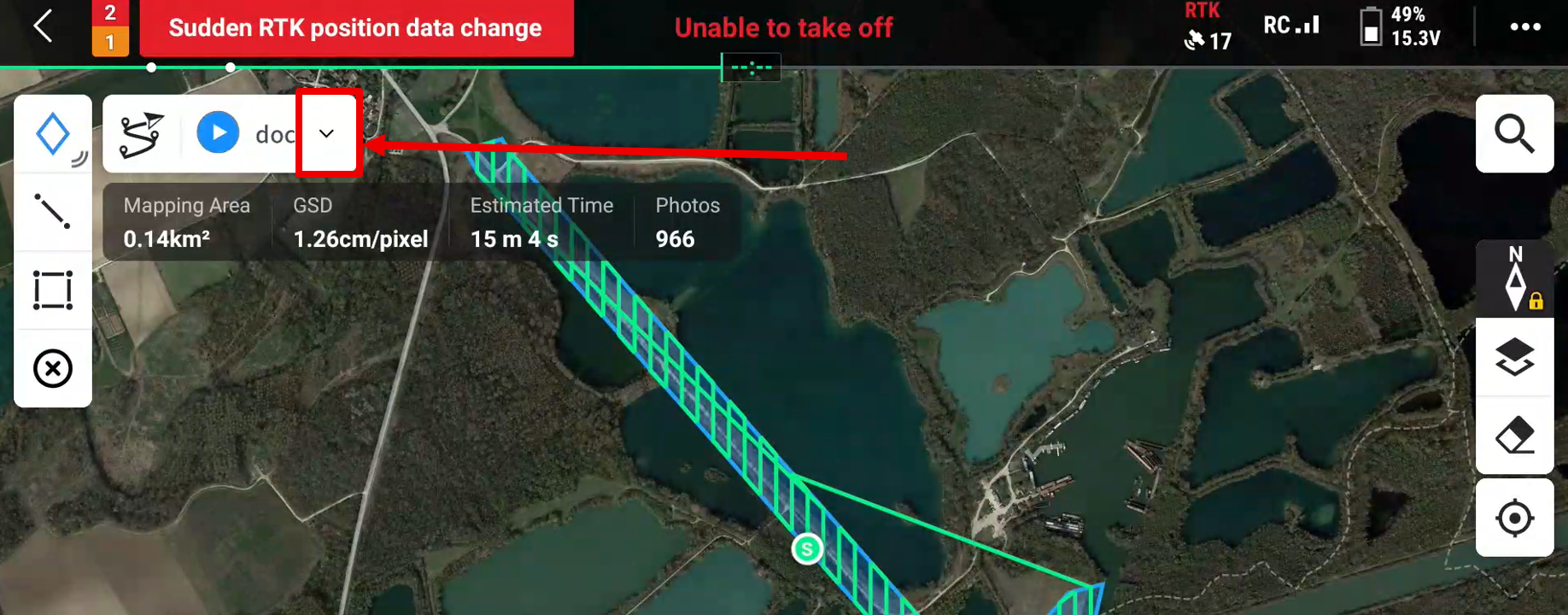
- Click on the pencil icon to edit the flight.
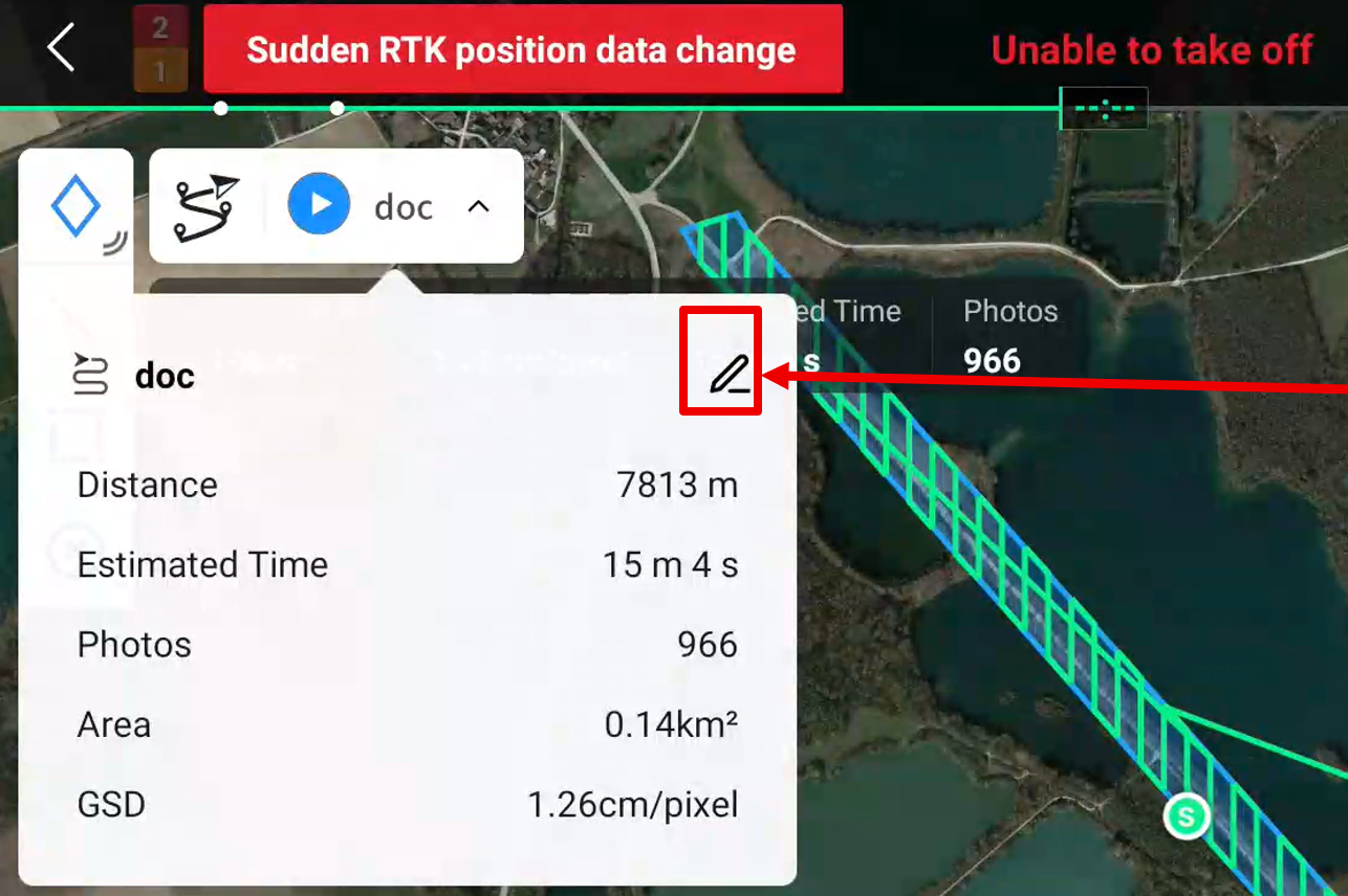
- Rename the flight as desired.
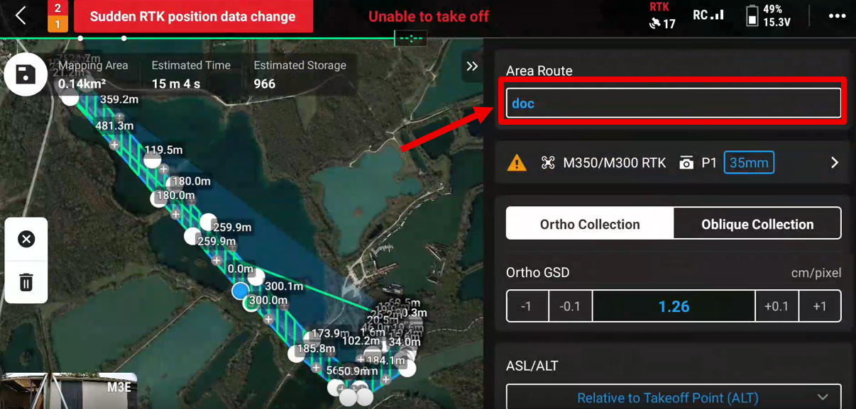
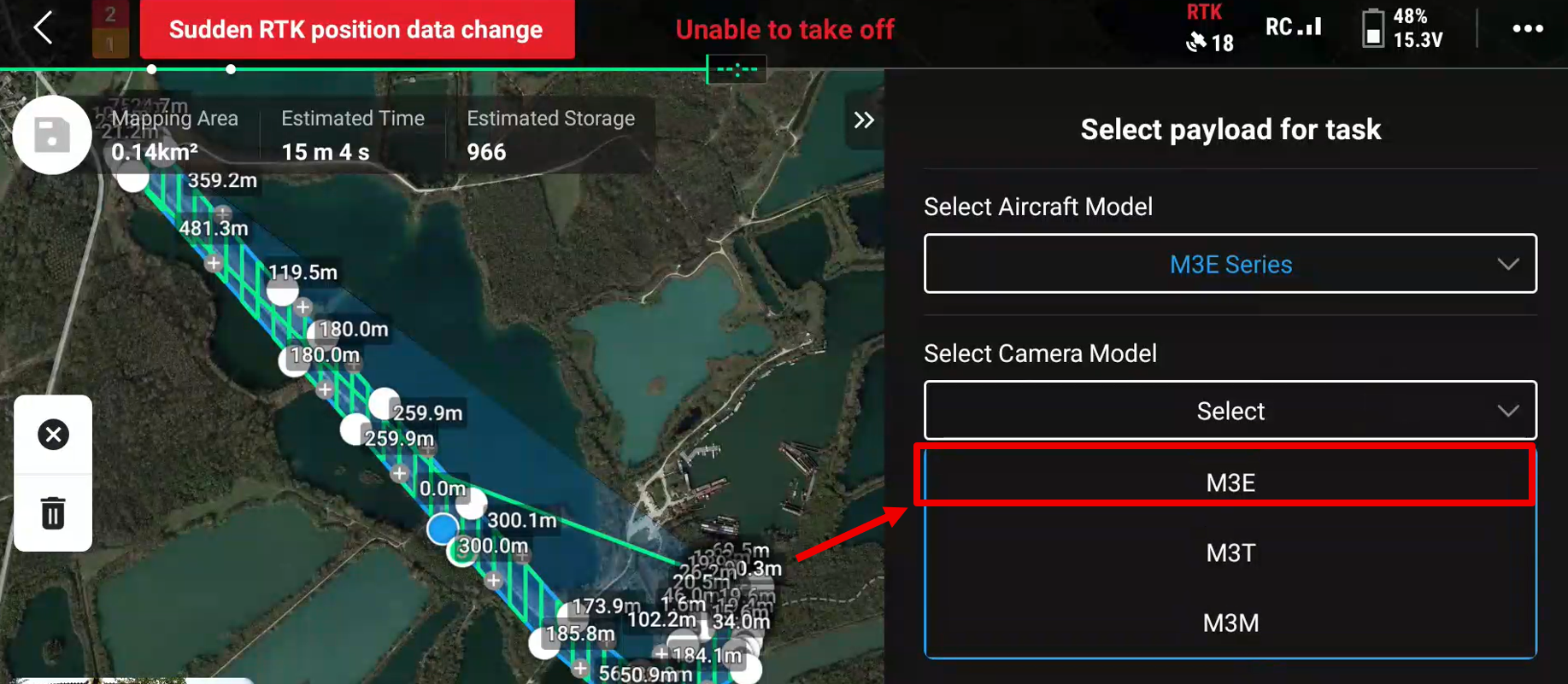
- Click on the dropdown menu for drone selection.
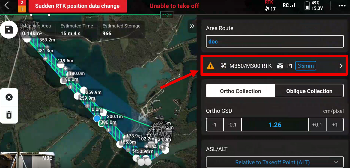
- Click on M3E Series, then on OK.
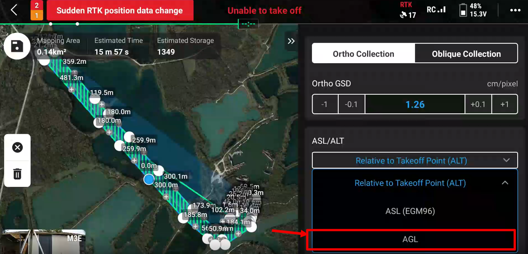
- Click on the dropdown menu for Altitude Mode (or ASL/ALT) and select AGL (Above Ground Level).
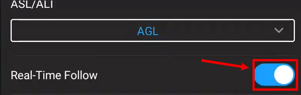
- Click on Real-Time Follow (Real-time Tracking).
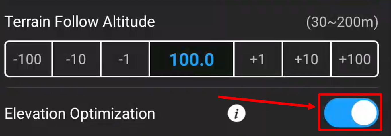
- Set the flight altitude to the desired flight height. Don't forget to tick Elevation Optimization
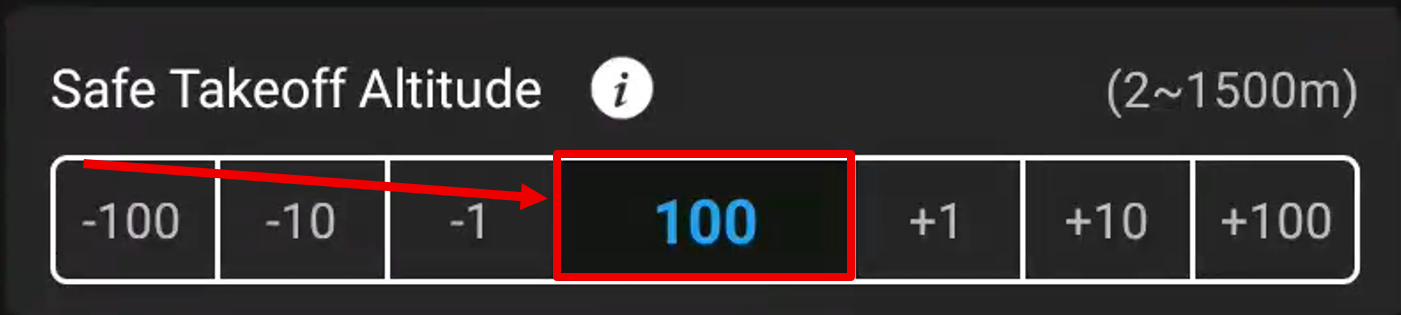
- Set the takeoff/landing safety altitude to 100 m
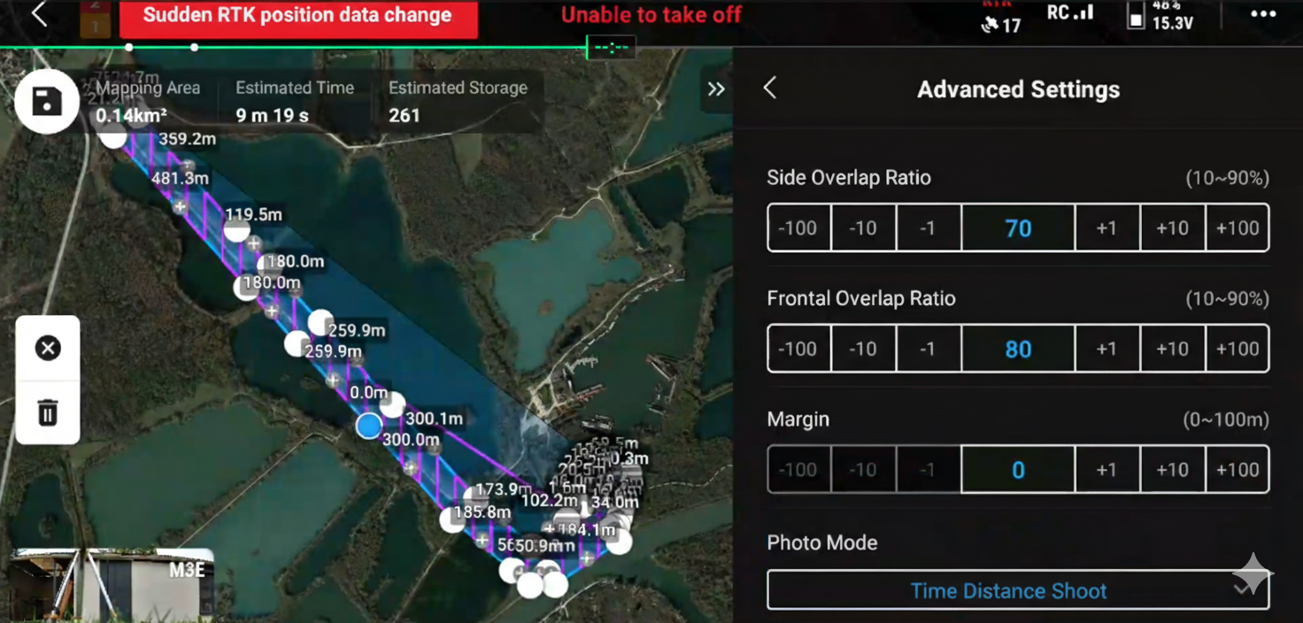
- Click on Advanced Settings at the bottom, and select "Time Distance Shoot".
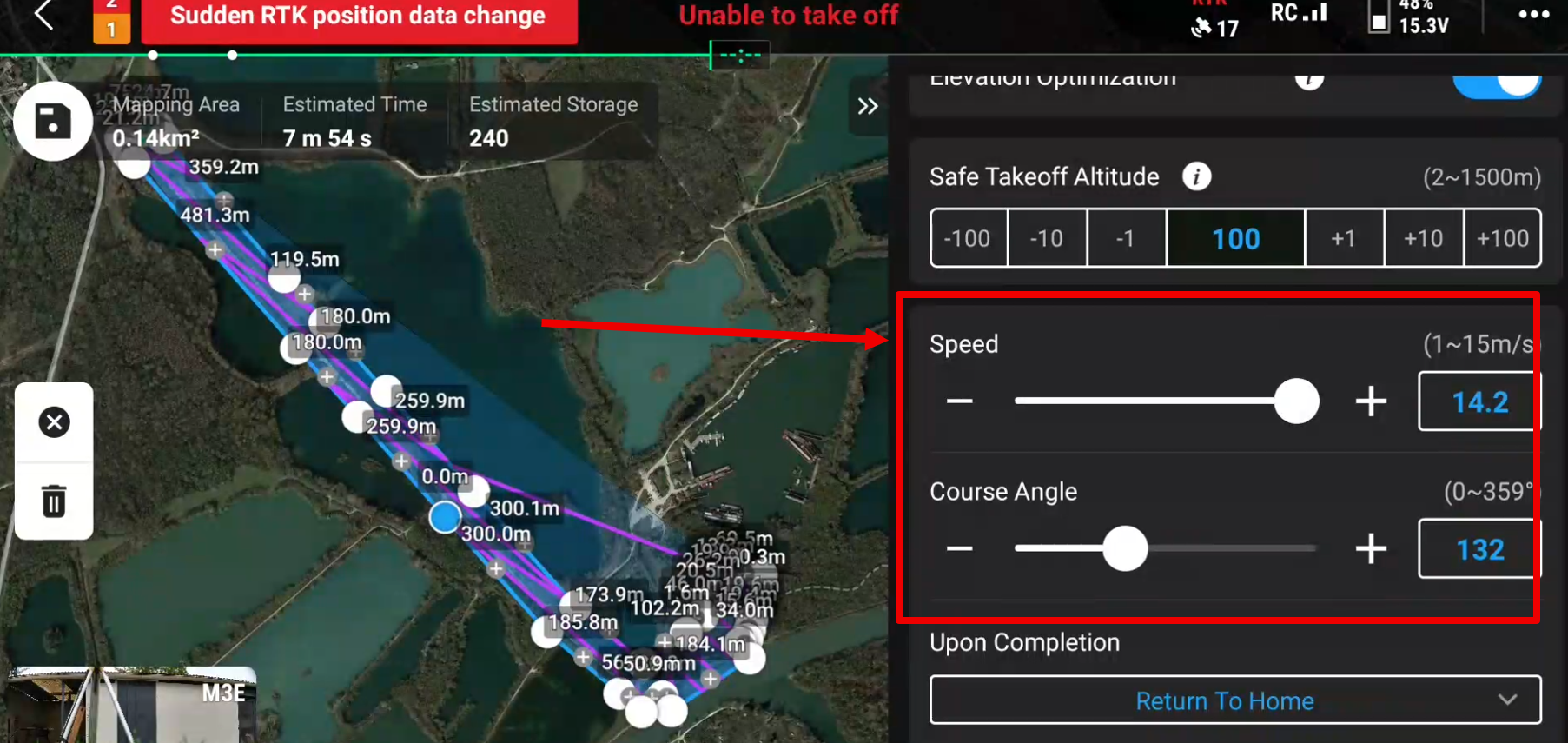
- Optimize the flight path angle to minimize total flight time. Adjust the flight speed based on ambient lighting conditions; brighter conditions allow for higher speeds, as shorter exposure times are required for the cameras.
- Click on the save icon in the top left to save the modifications.
¶ On the field
¶ 4. Georeferencement
¶ 4.1 With NRTK/NTRIP
TODO
¶ 4.2 With DJI base
- Locate a fixed point near the flight zone, position the DJI base on it, leveled and centered, and turn on the base.
Two solutions are possible:
- If the coordinates in Lat/Long/H ellipsoidal are previously saved in the Remote Controller go to section 4.2.3.
- If you only have projected coordinates, continue to section 4.2.1.
¶ 4.2.1 Transform projected coordinates to WGS84 LL
-
Install or go to the app.linaster.online application and open it on the phone.
-
Log in with your Linaster credentials.
-
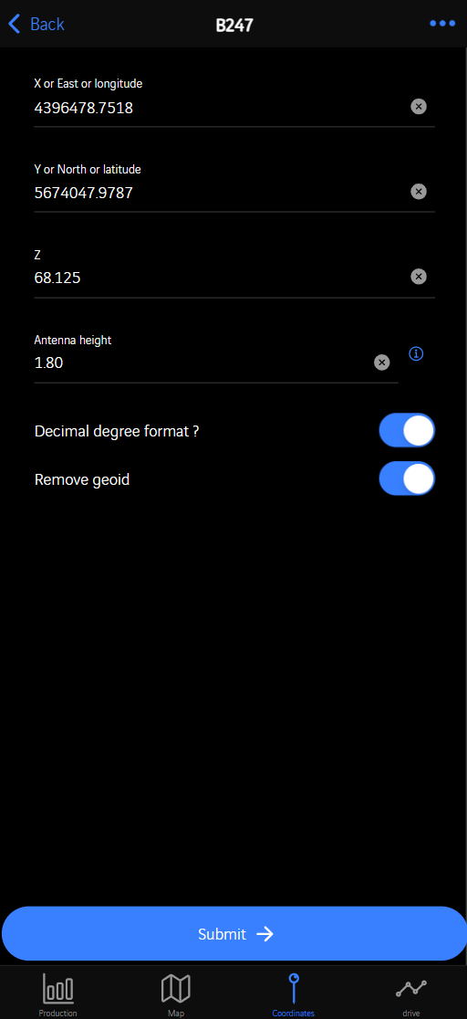
Click on the contract and go to Coordinates tab at the bottom of the screen.

-
Fill in the East, North, Z projected coordinates (site) of the point where the DJI base is positioned.
You need to enter at least 3 digits, otherwise the form cannot be submitted. -
Fill the "Antenna height" value (For DJI D-RTK2=1.80m).
-
Leave the 2 other values ticked.
-
Click on SUBMIT
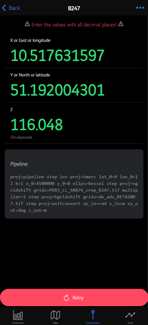
- The coordinate conversion is completed. Note the coordinates with ALL decimals
¶ 4.2.2 Add Coordinates into DJI Base
Keep the DJI D-RTK base AND the drone ON.
-
Open your flight plan.
-
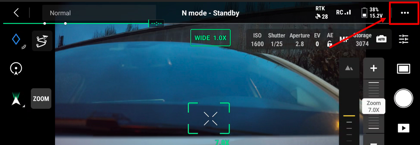
Click on the 3 dots in the top right of the screen.
- Click on the RTK tab, and verify that:
- "RTK positioning" is ON
- ⚠️⚠️⚠️ "Maintain positioning accuracy mode" needs to be unchecked ⚠️⚠️⚠️
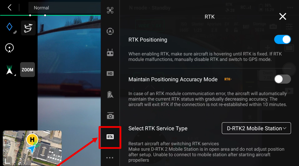
- Verify the RTK service: D-RTK2 Mobile Station
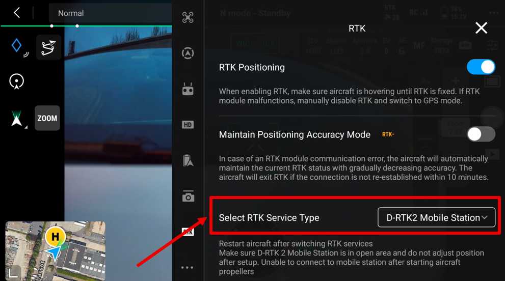
- Scroll the window to the bottom and click on Advanced Settings
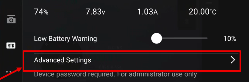
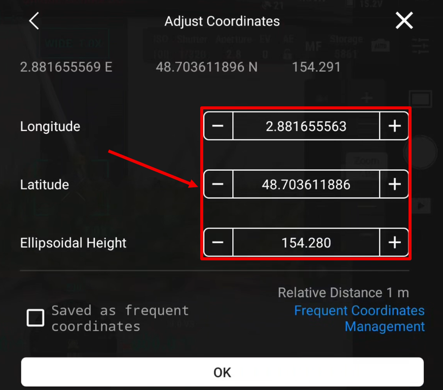
- Enter the password: 123456 and click on ADJUST COORDINATES.
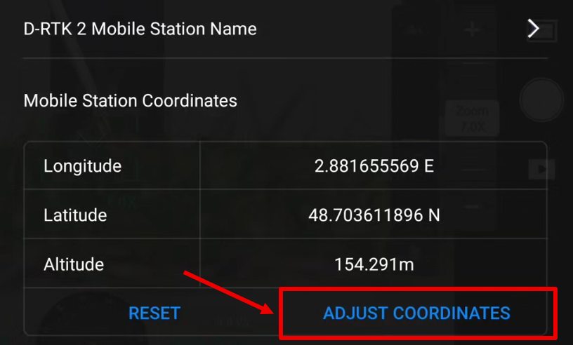
- Enter the Lat/Long/Hell coordinates converted previously with at least 8 decimals (except for Hell).
-
If this point needs to be saved for future operation, tick "saved as frequent coordinates". Give it a name.
-
Click on OK and restart the drone.
-
Go back to the camera view.
-
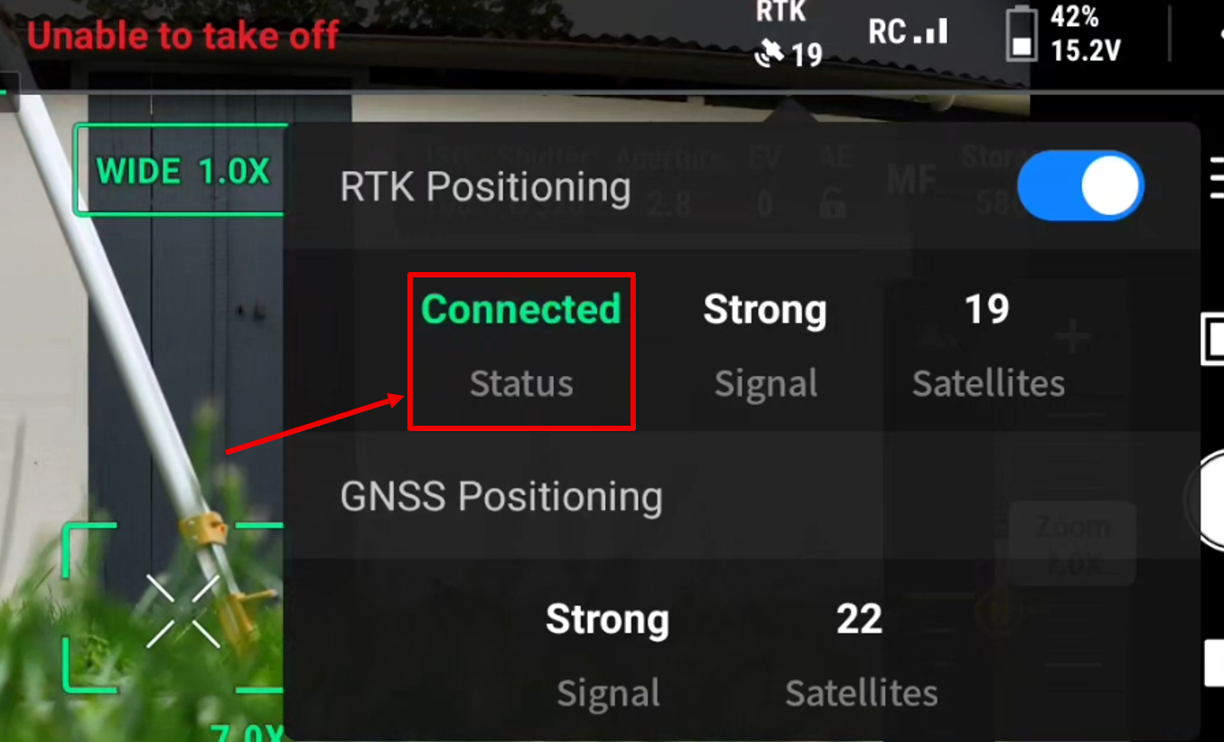
Click on RTK at the top of the screen, once the drone is reconnected.
-
Wait/check the Status will change to CONNECTED mode.
E.g.: "Connected" = RTK Fix, "Converging..." = RTK float.
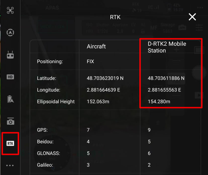
- ⚠️⚠️⚠️**Re-open the RTK tab and verify that the DJI base coordinates are the converted ones**⚠️⚠️⚠️
¶ 4.2.3 Setup georeferencement with a known Point
Keep the DJI D-RTK base AND the drone ON.
-
Open your flight plan.
-
Click on the 3 dots in the top right of the screen.
- Click on the RTK tab, and verify that:
- "RTK positioning" is ON
- ⚠️⚠️⚠️ "Maintain positioning accuracy mode" needs to be unchecked ⚠️⚠️⚠️
- Verify the RTK service: D-RTK2 Mobile Station
- Scroll the window to the bottom and click on Advanced Settings
-
Enter the password: 123456 and click on ADJUST COORDINATES.
-
An alert proposes a known point in the remote controller.
-
Click on ADJUST.
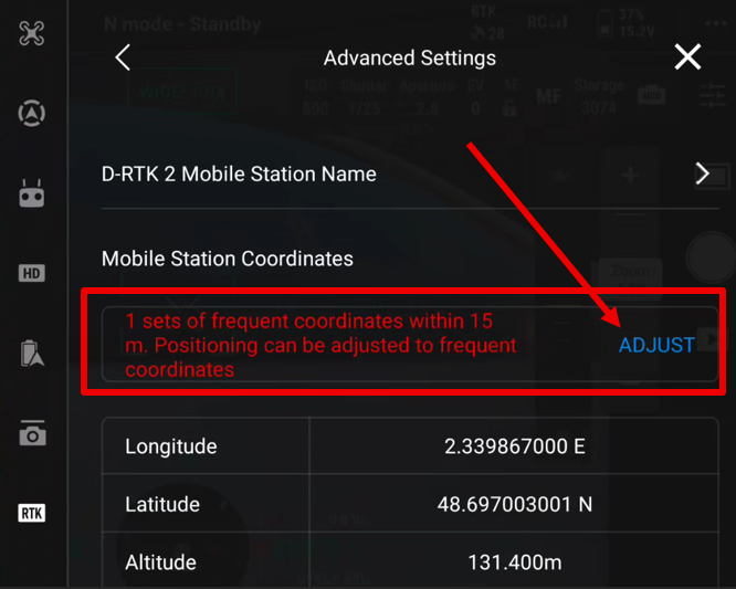
- Select the correct point from "Frequent coordinates".
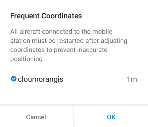
-
Click on OK and restart the drone.
-
Go back to the camera view.
-
Click on RTK at the top of the screen, once the drone is reconnected.
-
Wait/check the Status will change to CONNECTED mode.
E.g.: "Connected" = RTK Fix, "Converging..." = RTK float.
- ⚠️⚠️⚠️**Re-open the RTK tab and verify that the DJI base coordinates are the converted ones**⚠️⚠️⚠️
¶ 5. Target Preparation
To control the photogrammetric survey, you need ground control points (GCP).
-
Place at least 4 targets uniformly on the surveyed area and use your GNSS pole to measure the center of each one.
Never give the same name to two GCPs. -
Secure the targets firmly to the ground and especially do not remove them until the drone flight is completed.
-
To avoid having to manually point the targets in the images (during the processing stage), we have an algorithm that automatically detects these GCPs, but they must be black and white.
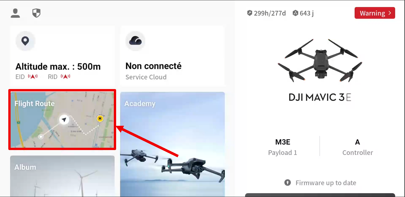
¶ 6. Flight Launch
Once all flight parameters are checked, the DJI base is properly georeferenced, and flight conditions are still valid, you can launch the flight.
-
Check the safety parameters and validate (NEXT).
-
During the flight, always keep eyes on the drone's behavior, either through visual control or on the screen: you are responsible in case of an accident or problem!
-
At the end of its mission, the drone will return to the takeoff zone.
¶ 7. Data Download
-
Remove the SD card from the drone.
-
Insert it into the SD port of the computer.
-
On the computer, access the DCIM/Survey folder.
-
Copy all images and all files into a new folder on your computer.
If you want to merge multiple flights, put all images into the same folder. -
In this new folder, place the target file from the GNSS survey. It must be in ASCII format with:
-
Name X Y Z(space, semi-column, tab column separated). -
"SYN" file format from WALKER.
-
¶ 8. Integration into Linaster
Go to birdflight_module wiki page to import the flight(s) into Linaster.