¶ Export From CAD
-
Open AutoCAD and find the layer where the data is:
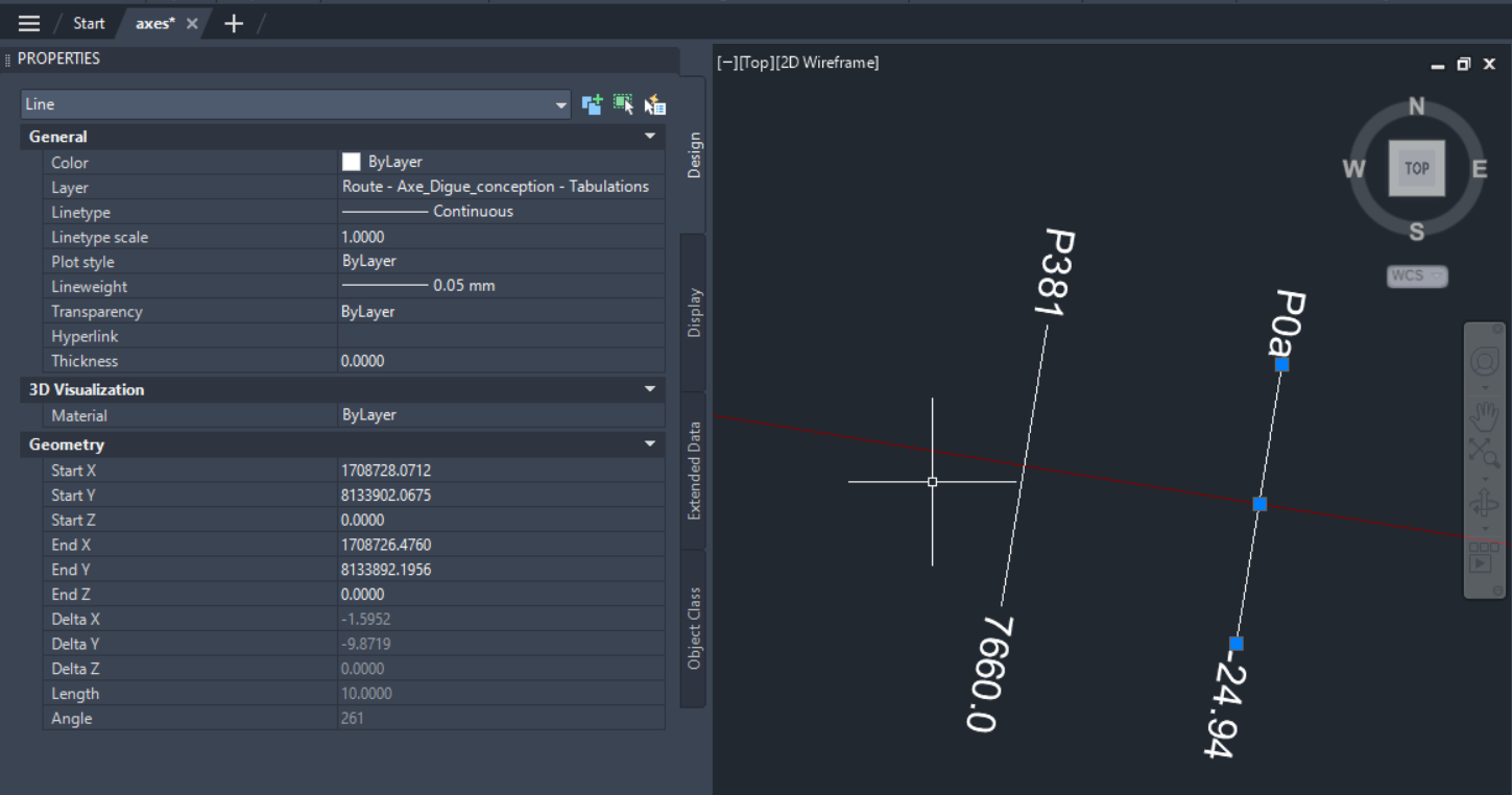
-
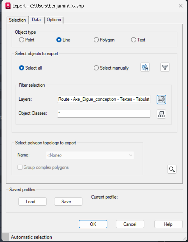
Type "MAPEXPORT", select "shp" file and path. In "Object Type" set the type of the features, in "Filter selection / Layers" find the layer previously found. And click "OK"
¶ Formating
- Make one file for each layer (Eg. axes, tabs and text of tabs)
- Import "SHP" files into Qgis
¶ Axes generation
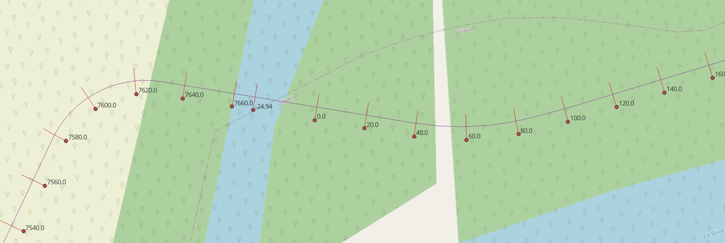
¶ Tabs generation
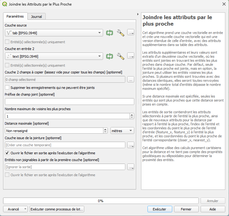
- Join attributes of text of tabs into tabs by using qgis function named "Joindre les attributs par le plus proche".
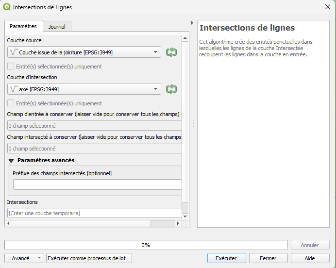
- Intersect axes by previously generated file by using qgis function named "Intersections de lignes".
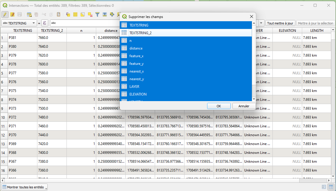
- Clean attributes of previously generated points
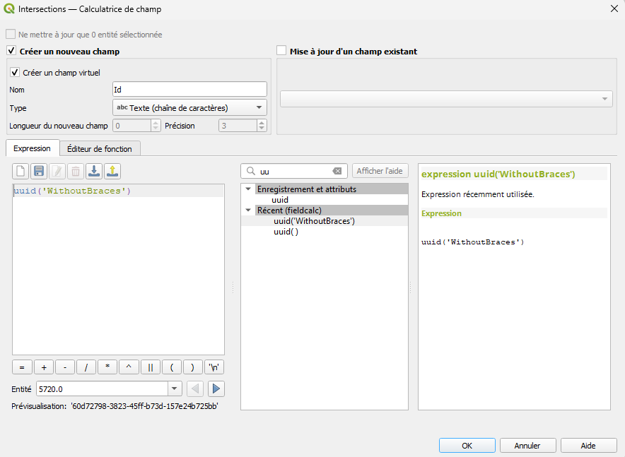
- Add attribute "Id" where is a function "uuid('WithoutBraces')"
- Add "Chainage" attributes by:
- QGIS add new attribute to decimal and put this function (replace 'axe' by layer name of your axe):
with_variable('line', overlay_nearest('axe', $geometry, limit:=1)[0],
    with_variable('from_start',
  	round(line_locate_point(@line, $geometry),4),
    @from\_start
    )
  )
- Python
import geopandas
from shapely.geometry import LineString, Point

def snap_along_linestring(linestring: LineString, points: [Point]):
    new_points = []
  for point in points:
  	new_points.append(linestring.interpolate(linestring.project(point)))
    return new_points dist = []
  lines = geopandas.read_file(r'<PATH_OF_YOUR_AXE.shp>')
  points = geopandas.read_file(r'<PATH_OF_YOUR_LANDMARKS.shp>')
  points['Chainage'] = None
  for idL, line in lines.iterrows():
  	for idP, point in points.iterrows():
    	points.chainage[idP] = round(line.geometry.project(point.geometry),3)
  points.to_file(r'<PATH_OF_YOUR_OUTPUT.shp>')
- Add attributes:
- "ShowAt"=2000
- "LandlineId"="<uuid_of_landline_in_linaster>"
- "Name"="<name_of_point>" Eg. in example just renaming attribute "TEXTSTRING_2"
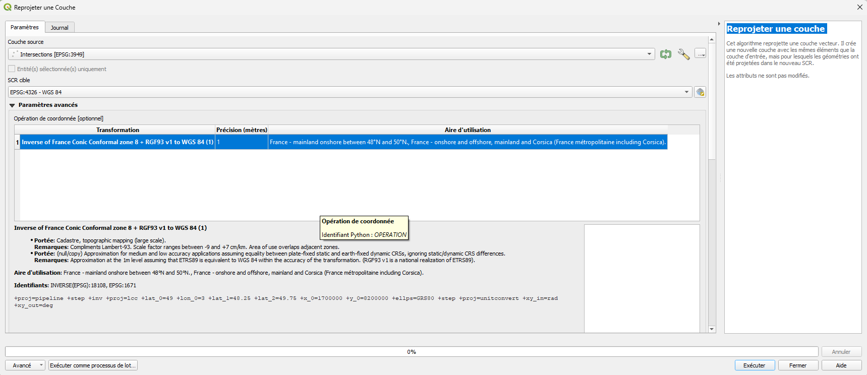
- Reproject the file in 4326 by using qgis function named "Reprojeter une couche". ⚠️_SELECT THE RIGHT TRANSFORMATION FROM GRID_⚠️
- Save this file in shp.
¶ shp2pgsql
Download the binary shp2pgsql here and extract it.
¶ SHP file to sql lines
./shp2pgsql -a -k -s 4326 -g Geography '<PATH\_OF\_LANDMARK.shp>' public.Landmark > landmark.sql
Open the file generated and rename all Geography by "Geography". if the import don't work try on not reprojected file:
./shp2pgsql -a -k -s <EPSG\_OF\_FILE>:4326 -g Geography '<PATH\_OF\_LANDMARK.shp>' public.Landmark > landmark.sql